

JOE BUDD
WILDLIFE
MANAGEMENT
AREA
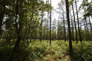
In addition to on-site wetland preservation, Florida Department of Corrections proposed to conduct off-site mitigation activities at the Joe Budd Wildlife Management Area (WMA) in order to achieve the mitigation points required for the Gadsden Re-Entry Center project. Many years ago Tram Road was constructed from beginning in an upland area and continuing into the wetlands near the confluence of Monroe Creek and the Little River. It is speculated that this tram road facilitated the logging of the seepage slopes and floodplain wetlands adjacent to and in the vicinity of the road. The tram road is approximately 1,900 feet in length. As it leaves the uplands going in a westerly direction, it traverses seepage slopes wetlands similar to those proposed for impacts at the DOC facility. Drainage patterns in this area were historically from north to south, toward Monroe Creek. Near the middle portion of the road, historic drainage patterns would have been in more of a westerly direction, toward the floodplain of the Little River. Construction of the road, which has no drainage culverts or low-water crossings in the eastern half, has altered historic flows in that area. Where surface drainage in this area was historically to the south toward Monroe Creek, flow is now diverted to the west along the road toward the floodplain of the Little River. In the western half of the road, flow continues to move toward the west toward the Little River, as it historically did. In addition, there are several areas of low elevation in the western portion of the road where flows cross the road during period of high water.
Based on the topography of the area and elevations of the road, it was proposed to remove approximately 860 feet of the road (860 feet long by 30-feet wide) to restore more natural drainage patterns. Spoil from the road removal was placed into the borrow area that existed alongside the road, returning both the road and the borrow area to natural grade. The borrow pit was 689 feet by an average of 28 feet wide, for a total square footage of 18,930 (.43 acres), or 3,327 cubic yards. There was a berm on the south side of the borrow pit and it was proposed that the berm be removed and the fill be deposited in the borrow pit to ensure sheet flow was restored. It is estimated that an additional 1,000 cubic cards of fill would be required to completely return the borrow pit to grade. This fill was either to be from the borrow onsite, or compatible soils obtained from offsite sources. The Division of Forestry had final input as to the location of the source material.
This mitigation plan provided numerous benefits to the wetlands and associated water bodies. Obviously, re-creating wetlands by planting the appropriate species in filled and borrow areas that are returned to natural grade will replace those wetlands that were lost. It will also increase the treatment of run-off into adjacent wetlands and water bodies. This is especially important considering the Ochlockonee River and Lake Talquin are designated as Outstanding Florida Waters by FDEP. Removal of the fill road and filling the borrow areas would also allow for increased animal species movement through the wetlands and to-and-from Monroe Creek and Little River as well as into the adjacent uplands.
WHAT
Topographical
Renovation
WHERE
Quincy, FL